


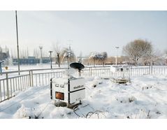
Doppler Wind LiDARs for Weather and Climate Observations - Monitoring and Testing - Meteorological Monitoring
Measures the boundary layer wind field in real-time all-weather. Widely used for meteorological climate research, short-term weather forecast and model optimization, aerosol parameter inversion, low-level wind shear detection.
RESEARCH AND MONITORING OF STRUCTURAL WIND-INDUCED DISASTER
Programme overview
Atmospheric turbulence is the irregular fluctuation of air flow with space-time in three-dimensional space.
Cause of turbulence:
1. The gradient of horizontal wind speed with height caused by friction with underlying surface;
2. Air buoyancy caused by heat exchange with underlying surface and change of air density.
Features of the scheme
Lidar-based turbulence inversion methods: PPI mode structure function method, RHI scanning mode structure function method, turbulence parameter inversion based on vertical wind profile mode.
RESEARCH AND MONITORING OF STRUCTURAL WIND-INDUCED DISASTER
Programme overview
Before bridge construction, it is necessary to evaluate the construction environment, in which the assessment of wind field is very important. After the completion, long-term wind condition monitoring should be carried out to judge the wind resistance of the bridge. As bridges become larger and lighter across the border, the probability of wind damage on the bridge increases. The study of bridge wind resistance and the prevention of wind damage have become a great concern for bridge design and site selection. The research on wind resistance of bridges has long relied on wind measurement towers, but the disadvantages of wind towers such as cost, inportability, and high installation environment requirements have been fully exposed. Thanks to its high precision, small size, scannable monitoring, flexible and convenient features, wind lidar has brought new monitoring methods to the study of bridge wind resistance.
Features of the scheme
We designed two scanning modes for bridge wind resistance monitoring, which are bridge virtual wind tower mode and bridge deck wind field measurement mode.
1) Measure the vertical wind profile of the four virtual wind measuring towers of the bridge;
2) Measure wind speed and direction at multiple measuring points on the horizontal bridge deck.
FINE MONITORING AND SIMULATION OF URBAN WIND FIELD
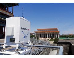
Programme overview
The urban wind field is the unique wind of big cities due to the combined effect of urban heat island effect and street narrow valley effect. It has an impact on convective weather, precipitation, dry and wet distribution, and forms many unique climatic characteristics in urban areas. The atmospheric pollutants discharged from factories in the suburbs can be collected into the urban area to increase the concentration. In addition, the streets lined with tall buildings on both sides can also form a small-scale 'street wind' circulation due to the difference in heating between the roof and the 'narrow valley'. At the same time, the city can also create local strong winds and cause disasters.
The scanning wind lidar can acquire micro-scale and high-resolution wind field information by customized scanning modes.
Features of the scheme
Grid wind field data of different heights can be achieved by full range cone scanning with multiple elevation angles.
Combined with the urban scale by fast scanning model, the short-term and impending prediction of urban scale wind field can be realized.
Extreme Weather Monitoring and Forecasting
Numerical weather prediction models require more comprehensive local observations (such as 3D wind fields) as initial conditions, but existing meteorological observation networks lack high-resolution dense observation data. Hence new Lidar products are needed to provide accurate 3D data observations and enhance the vertical observation capability of the meteorological system. The construction of wind Lidars network can realize:
1. Improve the accuracy of numerical forecast and provide data support for early warning of typhoons, rainstorms and other weather.
2. Establish a three-dimensional urban wind field model to provide accurate monitoring data for urban pollution forecasting.
The quantity and quality of atmospheric observational data used by meteorologists and weather forecasters increases year by year, but the continuous improvement of forecasting skills remains a challenge. Mainly due to the difficulty of accurately determining initial conditions, in order to accurately delineate the atmospheric boundary layer, especially wind profiles, in high-resolution numerical models, it is necessary to improve observations at regional and local scales. In addition to the uncertainty of weather forecasts, there is also improved monitoring of severe and extreme weather events (severe thunderstorms, typhoons and other mesoscale phenomena) that can adversely affect human life, property and business.
The meteorological agencies need to monitor all atmospheric parameters, such as wind, turbulence, clouds, and aerosols, in order to provide accurate short-term forecasts and contribute to effective crisis management. Leice's lidars perform 24/7, real-time measurement and high-level data processing, which help provide increasingly accurate forecast models.