Several meteorological agencies have decided to deploy LIDAR networks to aid decisionmaking in case of volcanic ash events. This includes the Met Office in the U.K, which decided to implement a national network as a direct consequence of the Eyjafjallajokull Icelandic eruption in 2010. The Met Office LIDAR network currently consists of 10 Raymetrics depolarization Raman systems scattered around the country, including one system contained in a mobile van. Raymetrics has deployed other networks and systems in Italy, Germany, Indonesia, South Korea, Singapore, China, while several other projects are under way

Raymetrics S.A.
Raymetrics - Volcanic Ash Detector
FromRaymetrics S.A.
Minimizing disruption to flights during a Volcanic eruption. Volcanic ash presents a global issue for the aviation industry. In recent years volcanic events have resulted in grounded flights around the world for periods up to 30 days. Volcanic ash plumes are subject to long-range transport and are carried over large areas by strong winds, causing major disruption to the global air transport industry. Combining a decade of innovative development Raymetrics provides you with the best ground based remote sensing technology. Our systems detect ash clouds more easily and predict how they might spread, more accurately.
Most popular related searches
Accurate measurements of atmospheric content for Volcanic Ash Monitoring
- Vertical or 3D
Aviation | Meteorology
Remote Visibility
- SVR, RVR, VOR (Vertical Optical Range)
Fog Detection
- Incoming Fog Bank Detection
- Fog cannot bypass as with in-situ sensors
3D Cloud Base
- Remote Cloud Base – for forecasting
- Total Cloud Cover – in 3D
Volcanic Ash
- Definitive Volcanic Ash Identification
- Altitudes of Ash Layers
Aerosol Monitoring
- Partical Distinction
- Planetary Boundary Layer (PBL)
- Plumes
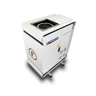
Introducing the revolution in remote observation on the atmosphere (clouds, volcanic ash, etc), the Raymetrics 3D Ceilometer is designed to work as a visual radar, as well as to deliver records of the radiation that is backscattered in the components of the atmosphere (molecules, aerosols, clouds, etc.)
- The information collected will allow improved forecasts on the dispersion of ash to support decision-makers in the aviation sector
- The deployment of Raymetrics systems will help the National Air Traffic Service to make decisions on flight safety across airspaces, based on the safety thresholds set by the Civil Aviation Authority and the International Civil Aviation Organization
- Significant cost savings for the Aviation Industry
- The system emits an eye-safe laser beam into the atmosphere. Laser light is scattered by particles in the atmosphere and some is returned to a telescope.
- Because the speed of light is known, the distance to atmospheric layers can be determined. From the properties of the light, certain atmospheric characteristics can also be determined