

Meteodyn
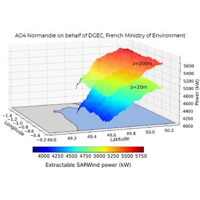
SARWind - Offshore Wind Resource Assessment
FromMeteodyn
Offshore atlas and EAP at surface or in altitude with possibility to integrate local measurement from the DeepC lidar buoy.
• High-definition offshore wind atlas to de-risk projects in the early phase.
• 1 km wind atlas grid all over the site.
• Optimized lidar positioning for measurement campaigns.
• Cost and time reduction of measurement campaigns.