

MAPSearch Corporation
- Home
- Companies
- MAPSearch Corporation
- Software
- MAPSearch - Electric Power GIS Data ...
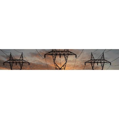
MAPSearch - Electric Power GIS Data Software
MAPSearch has completely rebuilt our previous North American Power GIS data set to bring you the most spatially accurate and up-to-date electrical power infrastructure database available. Using the latest satellite and aerial sub meter imagery, MAPSearch’s next generation electric power database gives you precise locations with accurate attribute data on a scale never before possible. Combined with MAPSearch’s industry leading petroleum and natural gas GIS infrastructure data, this electric power solution makes our energy data toolkit the most comprehensive and accurate anywhere.
Most popular related searches
electric power
electrical power
primary fuel
natural gas infrastructure
energy data
power infrastructure
electricity infrastructure
gas infrastructure
electric power generation
electrical power generation
Why Do I Need This?
- Use this information for planning, comparative analysis, project feasibility analysis and risk evaluation.
- Examine the geographic relationships among the various data components to identify new opportunities.
- Incorporate additional layers and proprietary information to increase analytical value.
- Create powerful visual presentations for project reporting.
Primary Package Includes:
- Transmission Lines: Thousands of miles of transmission lines in North America; includes voltage, voltage range, line type, status, owner/operator, spatial accuracy metacode
- Substations: Thousands of substations; includes substation name, type, status, owner/operator name, spatial accuracy metacode
- Power Plants: Plant information includes plant name, status, nameplate capacity, year installed, number of units, primary fuel, secondary fuel, primary mover, owner/operator, spatial accuracy metacode; dam information includes dam name, reservoir name, ownership, size code, max capacity, normal capacity, surface capacity, HUC, river name, year completed
Additional Layers:
- Public Power: Polygons representing cooperative service territories and REA owner as well as municipal, federal, and state agencies
- Investor Owned Utilities: Polygons representing IOU operating companies, includes owner/operator, number of customers
- ISO/RTO: Polygons including information on region name and industry abbreviation
- NERC Regions: Polygons including information on region name and industry abbreviation