FocusedGeo
FocusedGeo
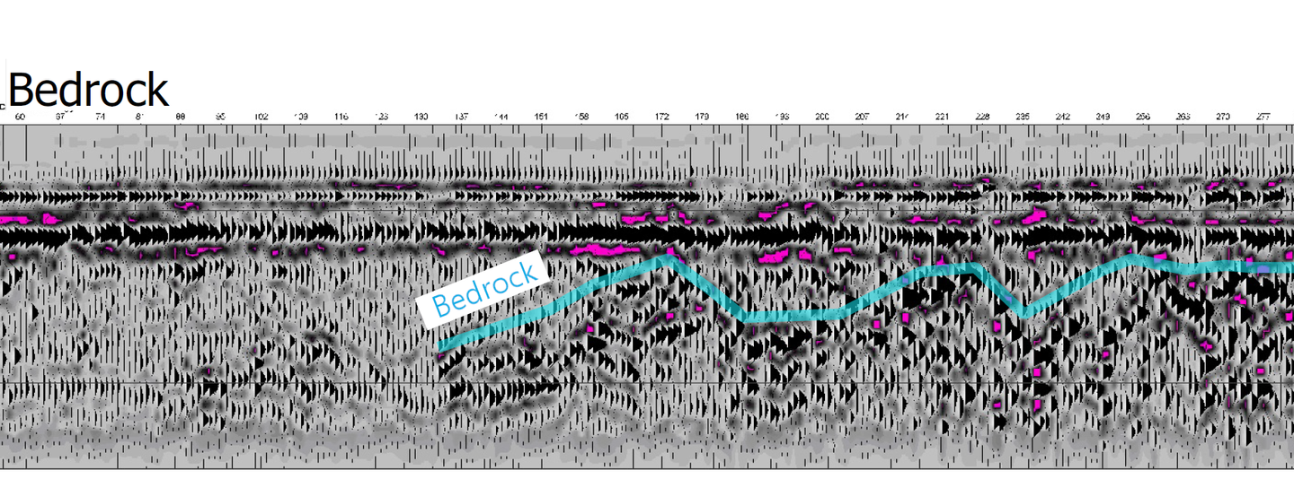
At Focused Geo we create maps of the surface and subsurface of the earth using aerial systems (satellite and remotely piloted aerial systems, aka, drones) as well as geophysical tools such as electromagnetic conductivity meters and ground penetrating radar instruments. We provide online mapping solutions for those requiring an interactive geographic interface for their data.
Company details
Find locations served, office locations.
- Business Type:
- Service provider
- Industry Type:
- Environmental Monitoring
- Market Focus:
- Regionally (various states or provinces)