
Qingdao Leice Transient Technology Co., Ltd. products
Wind Power Products
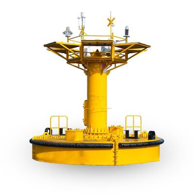
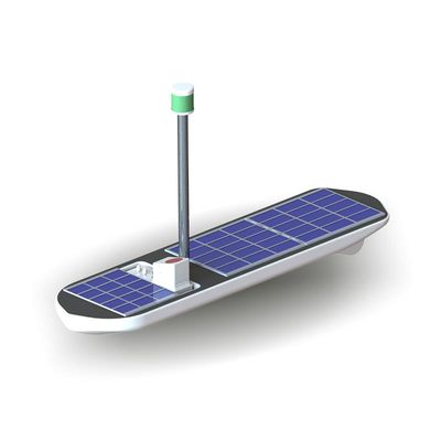
Leice - Model WindMast 350-MB - Floating Buoy Wind Lidar
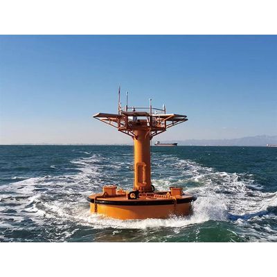
WindMast 350-MB system is developed based on fully independent intellectual property rights and includes a domestically produced wind lidar, a large buoy platform, a self-supply power system, BeiDou positioning and communication technology, and a motion platform attitude correction algorithm. The technical specifications have reached international advanced levels, ensuring accurate measurements and stable operation under harsh meteorological and sea conditions.
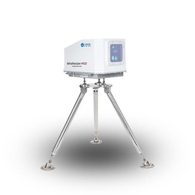
Leice - Model WindHorizon H400 - Nacelle Wind Lidar
The WindHorizon H400 is a compact and high-precision nacelle-mounted forward-looking pulsed wind lidar. It can accurately measure wind speed and direction at any of 10 configurable range gates from 50m to 400m directly in front of the wind turbine hub. Additionally, the WindHorizon series includes the H800 model, which extends the detection range to 800m.
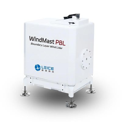
Leice - Model WindMast PBL - Boundary Layer Wind Lidar
WindMast PBL Boundary Layer Wind Lidar is based on the optical pulse coherence Doppler frequency shift detection principle, enabling fine detection of three-dimensional wind field in the atmospheric boundary layer. The lidar is available in two models: Type I is designed for precise wind field detection within 350 meters at low altitudes, with spatial resolution accuracy of up to 1 meter; Type II extends the detection range to 1500 meters, meeting a broader range of detection needs.
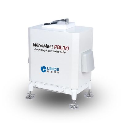
Leice - Model WindMast PBL(M) - Boundary Layer Wind Lidar
WindMast PBL(M) Boundary Layer Wind Lidar is based on the optical pulse coherence Doppler frequency shift detection principles. It is capable of fine detection of three-dimensional wind fields within the atmospheric boundary layer, up to a height of 3000 meters.
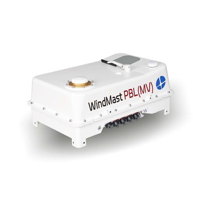
Leice - Model PBL(MV) - Boundary Layer Wind Lidar
WindMast PBL(MV) Boundary Layer Wind Lidar is based on optical coherent Doppler frequency shift detection principles. It is designed to meet the requirements for high-precision, refined detection of three-dimensional atmospheric wind fields within the atmospheric boundary layer up to a height of 3000m. The lidar is equipped with an integrated inertial navigation system (INS) and motion platform attitude correction algorithms, enabling real-time correction of wind field data. Its flat and lightweight design allows for flexible installation on various moving platforms, such as vehicles and vessels. This adaptability overcomes terrain and environmental limitations, enabling rapid wind field detection across plains, mountainous areas, and oceans. The system boasts broad application prospects across multiple scenarios.
Leice - Model WindMast PBL(SV) - Boundary Layer Wind Lidar
WindMast PBL(SV) Boundary Layer Wind Lidar is based on optical coherent Doppler frequency shift detection principles. It is designed to meet the requirements for high-precision, refined detection of three-dimensional atmospheric wind fields within the atmospheric boundary layer up to a height of 3000m.
Meteorological Products
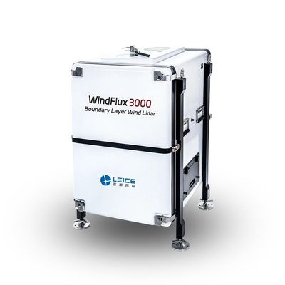
Leice - Model WindFlux 3000 - Boundary Layer Wind Lidar
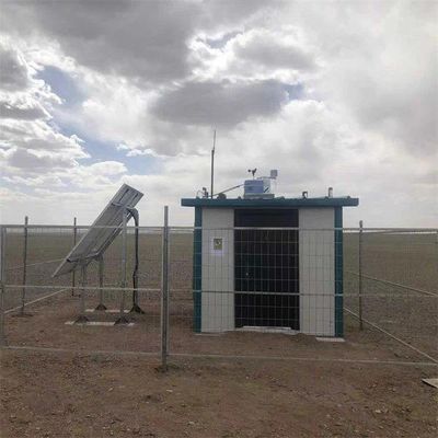
WindFlux 3000 Boundary Layer Wind Lidar is based on the optical pulse coherence Doppler frequency shift detection principle, enabling refined detection of the three-dimensional wind field in the lower and middle troposphere, including the atmospheric boundary layer. It provides real-time output of data products such as wind profiles, turbulence intensity, vertical airflow, boundary layer height, cloud base height, signal-to-noise ratio, backscattering coefficient, ground temperature, humidity, pressure, and more. The system is widely used in meteorological and climate research, assimilation of meteorological forecasting models, studies on atmospheric material fluxes, regional transport and diffusion of pollutants, and low-altitude wind shear detection.
Leice - Model WindMast PBL(MA) - Airborne Wind Lidar
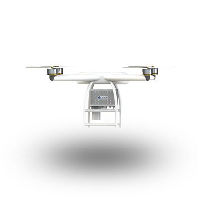
WindMast PBL(MA) Airborne Wind Lidar is a pulsed coherent wind lidar designed for use on airborne platforms, fully developed in compliance with IEC 61400-12-1:2017 standards. Its compact and lightweight structure offers smaller size, reduced weight, and enhanced adaptability to various working environments. The airborne wind lidar is easy to mount and flexible, making it suitable for multiple platforms. It can overcome terrain limitations, enabling the detection of wind field conditions in a variety of terrains such as plains, mountainous areas, and oceans in a short time. It is ideal for applications in environmental monitoring, fire emergency rescue, and other fields.
Wind Lidars - Wind Lidar System
Leice - Wind Speed Lidar
Wind speed lidar, also known as wind monitoring lidar or laser wind sensing, is a remote sensing device that measures wind speed and direction using optical sensing techniques. This technology has transformed the way we monitor and analyse atmospheric conditions, delivering precise and dependable data for a wide range of applications. Wind lidar has the ability to produce detailed measurements of wind speed and direction at various elevations, which is one of its key advantages. Wind speed detection technologies such as anemometers are confined to measuring at specified heights, whereas wind lidar can offer continuous data across the entire height of the atmosphere.
Wind Lidars - Offshore Wind Lidar
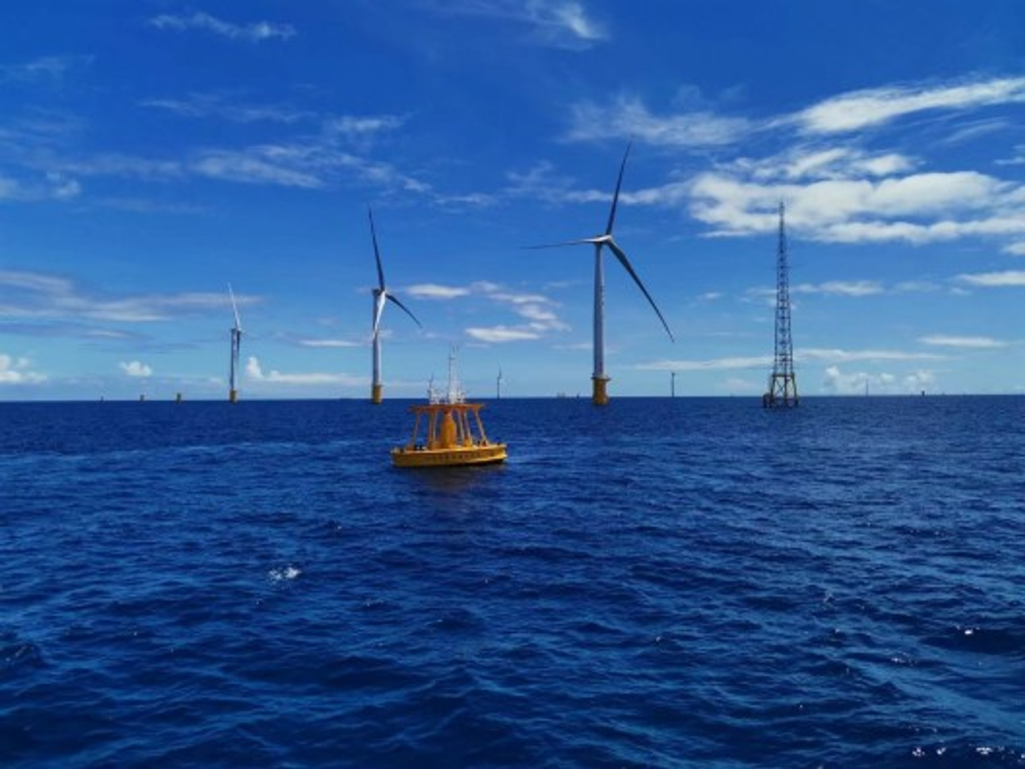
Leice - Floating Lidar Buoy
A floating lidar buoy is a buoy-based remote sensing system that uses lidar technology to measure wind speed, direction, and other atmospheric parameters at various heights above the ocean surface. It is specifically designed for offshore wind resource assessment and monitoring. A floating lidar buoy consists of a buoy that is equipped with a lidar sensor mounted on a mast. The lidar sensor emits laser beams towards the atmosphere, and the reflected light is analyzed to determine wind characteristics.