

- Home
- Companies
- Qingdao Leice Transient Technology Co., ...
- Products
- Leice - Model WindMast PBL - Boundary ...
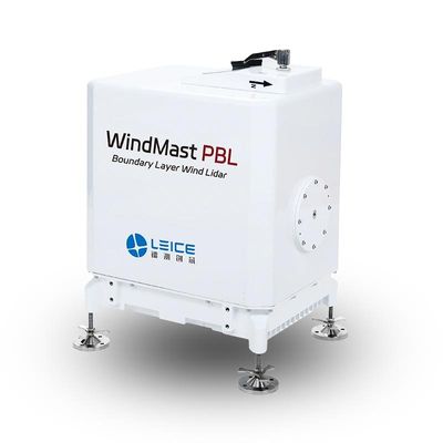
Leice - Model WindMast PBL -Boundary Layer Wind Lidar
WindMast PBL Boundary Layer Wind Lidar is based on the optical pulse coherence Doppler frequency shift detection principle, enabling fine detection of three-dimensional wind field in the atmospheric boundary layer. The lidar is available in two models: Type I is designed for precise wind field detection within 350 meters at low altitudes, with spatial resolution accuracy of up to 1 meter; Type II extends the detection range to 1500 meters, meeting a broader range of detection needs.
Real-time output of wind profile, turbulence intensity, vertical airflow, boundary layer height, cloud base height, signal-to-noise ratio, backward scattering coefficient, ground temperature and humidity pressure and other data products.
It is widely used in meteorological and climatic research, assimilation of meteorological forecasting models, studies of atmospheric material fluxes, regional pollutant transport and diffusion, and low-altitude wind shear detection.
- Bankable accuracy
- High resolution
- Flexible deployment
- Unattended
- High robustness
- Human eye safety
- Low power
- Laser Wavelength: 1550nm
- Maximum Detection Distance: Type I 350m/Type II 1500m
- Spatial Resolution: Type I 40m~350m range any 24 heights, can be set resolution 1m. Type II 15m/30m/60m/150m(configurable)
- Time Resolution: 1s~10min(configurable)
- Wind Speed Measurement Accuracy : ≤0.1m/s
- Wind Direction Measurement Accuracy : ≤3°
- Weight: <30kg
Radial velocity, spectral width, spectral intensity, signal-to-noise ratio, horizontal wind speed, horizontal wind direction, vertical airflow, wind shear, turbulence intensity, wind shear index, backscattering coefficient, cloud-bottom height, boundary-layer height, GNSS position time, lidar status data, ground atmospheric temperature, humidity, and pressure data; when in mobile detection mode, the output of airspeed, heading, three-axis attitude data, and GIS-based three-dimensional wind field.
- Air Quality Improvement and Management in Key Regions
- Fine Traceability of Atmospheric Particulate Matter Pollution
- Analysis of Atmospheric Pollution Causes
- Meteorological Support for Fire Emergency Rescue
- Wind Measurement Network in Complex Terrain
- Integrated Meteorological Observation and Service Platform
- Refined Meteorological Observation and Forecasting
- Wind Power Prediction
- Preliminary Survey of Onshore and Offshore Wind Resources