
- Home
- Companies
- Qingdao Leice Transient Technology Co., ...
- Products
- Leice - Floating Lidar System
Leice - Floating Lidar System
The advanced remote sensing technology has enabled floating Doppler wind lidars to replace the traditional met masts as the trustworthy tool for wind measurement, not only in wind energy industry but also the meteorological areas.
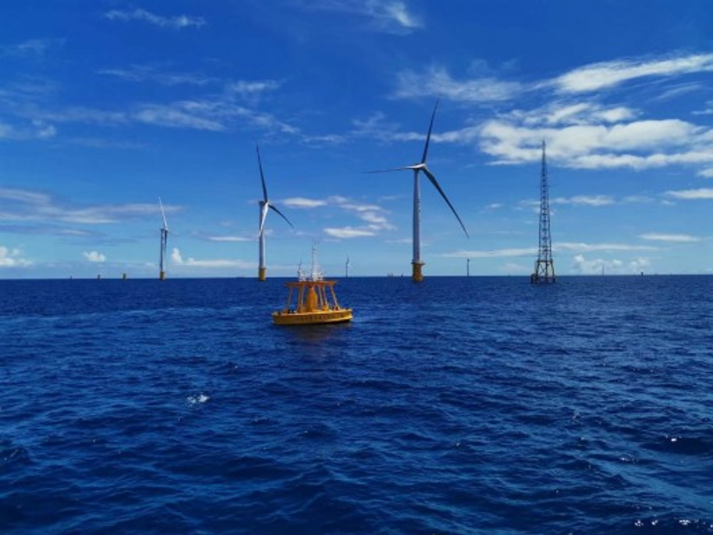
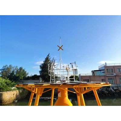
The Floating Lidar System is a floating laser remote sensing system that can accurately measure wind energy resources on the ocean. It uses lidar technology to accurately measure wind speed and direction, helping developers determine the wind potential of wind turbines. The main part of the system is a floating measurement platform, usually a ship or buoy, on which a high-precision lidar device is installed to determine the optimal deployment position of wind power equipment by measuring turbulence in the airflow and changes in airflow speed. The control center of the entire system can remotely monitor, conduct real-time analysis and processing of wind power prediction and measurement data, and provide more accurate data and suggestions for wind power projects.
Wide measuring range
Traditional wind measurement towers can only measure surface wind speed, while Floating Lidar System can measure wind speed data from sea level to heights of tens or even hundreds of meters, covering a wider range.
Real-time monitoring
We float a lidar on the sea, which can monitor wind speed and wind direction data in real time. However, traditional wind measurement towers require time for data analysis and processing.
Easy to install and maintain
Traditional wind measurement towers require the construction of deep foundations, but our products do not. You only need to place it in the appropriate water area to start monitoring.
High precision
Our products can achieve very high measurement accuracy, with measurement errors within 1-2%, while traditional anemometer towers have errors between 5-10%.
Highly mobile
Our product can be moved at any time and only needs to be towed to different sea areas for measurement, which also increases its advantage of being suitable for temporary offshore wind farm measurements.
Specification: Parameters
- Detection height: 10m (weather sensor), 40~350m (wind lidar)
- Wavelength: 1550nm, invisible eye safe
- Wind speed range: 0 ~ 75m/s
- Wind direction range: 0 ~ 360°
- Wind speed accuracy: 0.1 m/s
- Wind direction accuracy: 3°
- Buoy size (dia): 6m / 10m (optional)
- Max.wind resistance: ≤ 60m/s
- Max.wave resistance: ≤ 20m
- Max.current resistance: ≤ 6kn
- Power supply: Solar panel, battery
- Data output: Sec and time average wind speed/direction, max./ min. horizontal wind speed, mean square deviation of wind speed (turbulence intensity), wind shear index, vertical speed, SNR data, GPS position time, lidar status data, ground atmospheric temperature, humidity, pressure data
Offshore Wind Energy
- Accurate Wind Resource Assessment
- Power Performance Verification
- Site Selection and Feasibility Study
- Improve Power Generation