
- Home
- Companies
- Qingdao Leice Transient Technology Co., ...
- Products
- Leice - Floating Wind Lidar System
Leice - Floating Wind Lidar System
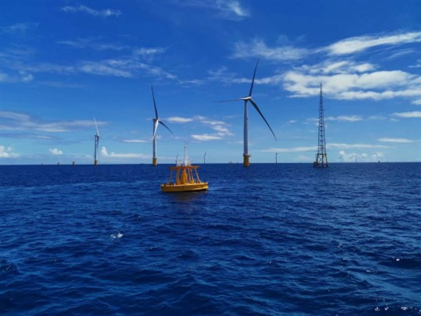
The stakeholders and developers are embracing the floating wind lidar systems as wind resource assessment tools for offshore wind farms, which greatly reduced the installation costs compared to fixed met masts in some cases, especially in the deep water areas.
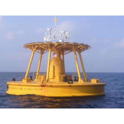
The Floating Wind Lidar System is a floating wind turbine detection system based on laser telemetry technology. Its basic principle is to use a laser beam to continuously scan the surrounding airflow and calculate the air speed and direction by measuring the echo time. Compared with traditional wind measuring towers, our product can not be disturbed by the ground, but can float next to the wind turbine as needed. This flexibility allows the system to directly measure airflow fields at varying heights, resulting in more accurate wind speed data.
Higher accuracy
The Floating Wind Lidar System measure wind speed and direction more accurately than traditional anemometers. LiDAR systems use laser technology to measure wind speed and direction more accurately than traditional instruments. In addition, it can measure winds at different heights in the atmosphere to better understand wind conditions at different heights.
Cost effective
Our products offer a cost-effective alternative to traditional weather masts, which are expensive to install and maintain. LiDAR systems are easier to install and require less maintenance, reducing the overall cost of installation.
Versatility
Our products are versatile and can be used in a variety of environments. They can be used at offshore wind farms, near the coast or in remote areas where land-based installations are not possible. In addition, they can measure wind conditions in real time, making them suitable for use in meteorological research and forecasting.
High reliability
Our products are highly reliable and capable of operating in harsh marine environments. It is designed to withstand strong winds, large waves and extreme temperatures. The lidar system is also designed to be self-contained and does not rely on external power or communications, ensuring uninterrupted operation.
Environmental impact
Our products have a low environmental impact. They do not need to be permanently installed on the seabed, which could disrupt marine ecosystems. Additionally, our system uses less energy and has a smaller carbon footprint than traditional weather masts.
- Detection height: 10m (weather sensor), 40~350m (wind lidar)
- Wavelength: 1550nm, invisible eye safe
- Wind speed range: 0 ~ 75m/s
- Wind direction range: 0 ~ 360°
- Wind speed accuracy: 0.1 m/s
- Wind direction accuracy: 3°
- Buoy size (dia): 6m / 10m (optional)
- Max.wind resistance: ≤ 60m/s
- Max.wave resistance: ≤ 20m
- Max.current resistance: ≤ 6kn
- Power supply: Solar panel, battery
- Data output: Sec and time average wind speed/direction, max./ min. horizontal wind speed, mean square deviation of wind speed (turbulence intensity), wind shear index, vertical speed, SNR data, GPS position time, lidar status data, ground atmospheric temperature, humidity, pressure data, Poland