
- Home
- Companies
- Qingdao Leice Transient Technology Co., ...
- Products
- Leice - Wind Speed Lidar
Leice - Wind Speed Lidar
Wind speed lidar, also known as wind monitoring lidar or laser wind sensing, is a remote sensing device that measures wind speed and direction using optical sensing techniques. This technology has transformed the way we monitor and analyse atmospheric conditions, delivering precise and dependable data for a wide range of applications. Wind lidar has the ability to produce detailed measurements of wind speed and direction at various elevations, which is one of its key advantages. Wind speed detection technologies such as anemometers are confined to measuring at specified heights, whereas wind lidar can offer continuous data across the entire height of the atmosphere.
What Is Wind Speed Lidar
Wind speed lidar, also known as wind monitoring lidar or laser wind sensing, is a remote sensing device that measures wind speed and direction using optical sensing techniques. This technology has transformed the way we monitor and analyse atmospheric conditions, delivering precise and dependable data for a wide range of applications. Wind lidar has the ability to produce detailed measurements of wind speed and direction at various elevations, which is one of its key advantages. Wind speed detection technologies such as anemometers are confined to measuring at specified heights, whereas wind lidar can offer continuous data across the entire height of the atmosphere.
Remote sensing capabilities
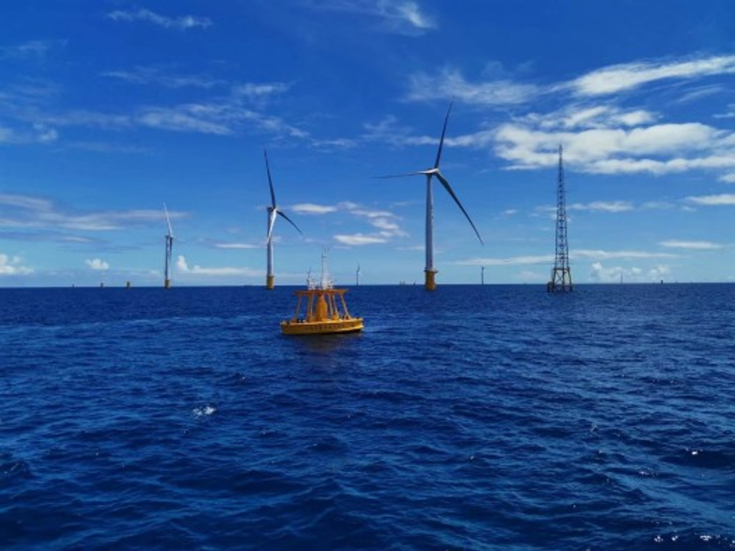
The most significant advantage of wind speed lidar is its remote sensing capabilities. It can measure wind speeds over long distances and in inaccessible locations, such as offshore wind farms or mountainous regions.
Real-time monitoring
Wind speed lidar operates in real-time, providing continuous wind speed data. This enables quick responses to changes in wind conditions, crucial for safety and operational efficiency in various applications.
High accuracy and precision
Wind speed lidar excels in providing highly accurate and precise measurements of wind speed and direction. Its ability to capture detailed wind profiles at various altitudes allows for precise assessments of wind resources.
Wide coverage area
Lidar systems can cover a wide area, making them suitable for large-scale wind resource assessments. They can quickly scan and map wind speeds over extensive regions.